03 May 2018

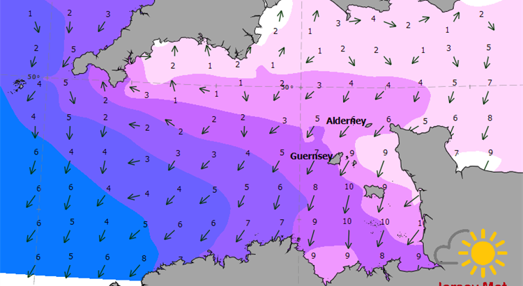
An improved weather forecasting service is being launched which will show the forecast wind direction on an hourly basis.
Improvements to Jersey Met’s existing wind and weather map have been made in response to customer feedback. Service users asked for hourly data maps and more detail around the Channel Islands.
From Friday 4 May the wind and weather maps will show 49 images every hour for three regions; the English Channel, Channel Islands and the Bay of St Malo.
Jersey Met’s computer systems gather data from a number of UK Met Office weather and wave models, and display the information as a map. Jersey Met’s systems add the latest real observations to the maps every hour for comparison.
Jersey Met forecasters Aimee Reading and Agatha Plunkett worked with the States digital team on the improvements.
Principal Forecaster John Searson said the improved service would be useful to Channel Islanders for planning sailing or sea activities, but would also come in handy for people planning a beach trip or a ferry crossing and who want to know the likely conditions.
He said “It’s important to stress that the maps must be used in conjunction with the Channel Islands Shipping Forecast – the official forecast for Channel Island waters. Jersey Met forecasters carefully analyse many computer models to make sure they are consistent with real weather and use their experience to adjust the shipping forecast and issue wind warnings based on much more detail, which in turn keeps the community safe.”